Introduction — From an Empire's Outlet to an Empire's Capital
Everyone enjoys the Giro d'Italia in a slightly different way. Some follow the battle for victory, some cheer for a favourite rider, and some simply watch the scenery sliding past at the edge of the screen. For three weeks, a Grand Tour keeps moving across a single country, covering some 3,400 kilometres in all. Draw that trajectory on a map, and it becomes, just as it is, the most extravagant route by which that country could be travelled.
The 2027 Giro d'Italia will be the 110th edition. It sets out on 8 May from Trieste, a port town in the north-east of Italy, and arrives in Rome on 30 May. Total distance: 3,418.9 kilometres. Elevation gain: 50,250 metres. The numbers alone are much like any other year's Giro. But set the names of the start and the finish side by side, and a contrast rises out of this year's course.
Trieste was once the Austro-Hungarian Empire's outlet to the sea — the one great port, you could say, of an empire that spread across the interior. Rome, by contrast, was the capital of a far older empire, and is the capital of the Italian Republic today. From the window one empire opened towards the sea, to the centre of another. And the road between them is not a gentle one. The first two days are entrusted to neighbouring Slovenia; the race then runs south along the Adriatic, crosses the Apennines, touches Naples — the southernmost point of this race — before turning north, and finally, deep in the Alps, crosses two sacred places, the Mortirolo and the Gavia, on one and the same day, passes the Zoncolan, and comes home to Rome.
From a border port to the Eternal City. That is the journey of the 2027 Giro. There will be no predictions here about who wins or loses. Each day the race leaves one town, follows a road, and arrives in another. It is that chain I want to follow, as a story of towns and roads.
Act I — The Border and the Adriatic (Stages 1–4)
Stage 1 — Trieste to Trieste (172 km)
Trieste is a strange town. On the map of Italy it sits folded small into the north-eastern corner, the Karst plateau behind it and the innermost bay of the Adriatic opening in front. From the fourteenth century, when it came under the Habsburgs, the town grew as the port of an inland empire. When it received the privileges of a free port in the eighteenth century, it swelled rapidly on the trade linking the Mediterranean with Central Europe. By the end of the nineteenth century the empire's wealth was gathering in this harbour, and around Piazza Unità d'Italia, which opens onto the sea, the imposing buildings of insurance companies and shipping lines stood in rows. It is also known as a city of coffee — because this was the port where the beans first came ashore, and roasters such as Illy are still based here today. In winter a cold north-east wind called the bora pours down off the plateau and races through the town's streets.
With the First World War the empire collapsed, and Trieste was incorporated into Italy. After the Second World War its status wavered as a Free Territory, until in 1954 it formally returned to Italy. Italian is spoken in the centre of town; in the villages of the outskirts, Slovenian is part of daily life. That layering is still part of the air of this place.
Stage 1 is a 172-kilometre circuit that starts and finishes in this Trieste. The elevation gain is 2,400 metres; a run of short climbs continues through the final 40 kilometres, so this is no simple flat stage to open the race. And according to reports, the course slips across into Slovenia along the way. On the first day of Italy's national race, the border is crossed almost casually. That, it seems to me, speaks well for the character of these three weeks.

Stage 2 — Ljubljana to Koper (166 km)
Stage 2 runs entirely within Slovenia. It starts in the capital, Ljubljana, and heads west to finish in the port town of Koper: 166 kilometres, with 2,200 metres of climbing. The Giro has borrowed the capital of another country as a stage start before, but to hand a whole day over to a neighbour, completely, is rare.
Ljubljana is a modest capital opened out along both banks of a river like a small stream, the Ljubljanica, and its riverside townscape is known for the work of the architect Jože Plečnik: the bridges over the river, the promenade along its banks, the colonnade of the market. In the first half of the twentieth century he remade his native city into a "capital for walking". Look down from the castle on its hill, and the red roofs of the old town overlap with the green ranges of hills beyond.
The finish is Koper — Koper in Slovenian, Capodistria in Italian. A port town at the northern end of the Adriatic, its old town keeps the strong imprint of its Venetian Republic days. On Tito Square stand the Gothic Praetorian Palace and the cathedral, and beyond the narrow lanes you can see the cranes of the harbour. Trieste and Koper are not even 30 kilometres apart along the coast. Yesterday the race left an Italian port; today it arrives at another port that once belonged to the same maritime trading sphere. Draw the border where you will — seen from the sea, it is all one bay, one event.


Stage 3 — Cervignano del Friuli to Possagno (163 km)
On the third day the race returns to Italy. From Cervignano del Friuli to Possagno, 163 kilometres, with 1,450 metres of climbing. It crosses the Venetian plain westwards, over the Montello hills and the Mostaccin climb, and arrives at the foot of Monte Grappa.
Possagno, the finish town, is the birthplace of the sculptor Antonio Canova. Famed across Europe for his white marble sculptures in the Neoclassical style, he left his home town a temple-like church of his own design. There is still a museum gathering his plaster models, and in the centre of this small town an unexpected quantity of "beauty" has accumulated.
Behind it stands Monte Grappa, remembered as the mountain where, in the First World War, the Italian army held back the Austrians. On its summit is a vast memorial ossuary for the war dead. The Montello hills, passed along the way, were likewise the stage of the Battle of the Piave River in 1918. This is a land where rivers and hills became lines of defence. From plain to mountain: in the north of this country, beautiful hill scenery and the memory of twentieth-century war quite often occupy the same ground. Stage 3 passes quietly through that overlap.
Stage 4 — Argenta to Misano Adriatico (151 km)
Stage 4 is, as a fourth stage perhaps should be, flat. From Argenta, near the southern edge of the Po delta, the race runs south along the Adriatic coast to Misano Adriatico, 151 kilometres. The finish is at the circuit that bears the name of Marco Simoncelli.
Around Argenta lies a land of rivers, lagoons and canals. As the Po's flow nears the sea it slackens, and eels are caught in the lagoons of Comacchio. The peloton sets out through that watery landscape, rides south along a coastline lined with resorts, and finishes at a circuit set a little inland. Simoncelli came from this region; he was the rider who lost his life in an accident during a race in Malaysia in 2011. The circuit took his name the following year. A bicycle race finishes in a place that carries the memory of another sport. Places where fast things gather tend to acquire such layers.
This will be a day for the sprinters, no doubt. But from the travelling side, it is also the day that closes the "sea chapter" before the mountains. Tomorrow the race folds inland, towards the Apennines.

Act II — Crossing the Apennines (Stages 5–9)
Stage 5 — Filottrano to Sarnano-Sassotetto (139 km)
The first summit finish comes in the inland Marche. From Filottrano to Sarnano-Sassotetto, 139 kilometres. The final climb to Sassotetto is about 13 kilometres at an average of roughly 7.4 per cent. Within a short distance, several heavy meanings are folded into this day.
The start town, Filottrano, is the home town of Michele Scarponi. Long active in the mountains and loved for his cheerful character, he died in April 2017 in an accident while training near this town. That the Giro chose his home town as a start is, in itself, a form of mourning. The peloton will leave the town quietly and enter the foothill ranges of the Apennines.
The inland Marche is a land of hills layered like folds as they rise from the Adriatic towards the mountains. On every hilltop a small town; between them, fields, olives and vineyards fill the gaps. Sassotetto is where, as the altitude rises, those hills turn into mountains, and the finish becomes a small ski station in winter. It is the day the coastal race first gets a proper hold of "height".
Stage 6 — Alba Adriatica to Lanciano (148 km)
Stage 6 runs within Abruzzo. From Alba Adriatica, on the Adriatic, inland to Lanciano: 148 kilometres, a stage of continuing undulating hills.
Abruzzo is one of the Italian regions where, as they say, the distance between sea and mountain is the shortest in the peninsula. Look inland from the coast, and the snow-capped massifs of the Maiella and the Gran Sasso come into view. Lanciano is a hill town overlooking the valley of the Sangro river, and in the Middle Ages it was a key point on the trade routes linking the interior with the ports of the Adriatic side. Wool and saffron were carried from the mountains to the sea, and pilgrims also passed through this valley. On the coast nearby, wooden fishing structures called trabocchi stand jutting out into the sea. Life on the water and life in the mountains — in this region the two are always back to back.
Today's course cuts diagonally across that back-to-back land, from the coast towards the mountains. There is no showy pass. But the succession of rises will shave the legs away little by little — a day very much of the Giro's first week.
Stage 7 — Sulmona to Campo di Giove (Individual time trial, 19.6 km)
Stage 7 is the first individual time trial of this edition. From Sulmona to Campo di Giove, a mere 19.6 kilometres, uphill in character, the second half climbing at a gradient of about 5 per cent.
Sulmona is known as the birthplace of the ancient Roman poet Ovid; a statue of the author of the Metamorphoses stands in the town square. The other thing that has made this town's name across Italy is confetti — sugar-coated almonds, indispensable as wedding favours. It seems to have nothing to do with the race, and yet layers of "the town speciality" like this are always mixed into the scenery of a travelling race.
The course climbs towards the embrace of the Maiella massif. Campo di Giove is a small mountain village, closed in by snow in winter. At 19.6 kilometres, this is less a time trial than the measurement of a single climb. Here, for once, the collective race is taken apart into individual races.
Stage 8 — Trasacco to Naples (219 km)
Stage 8 runs long: 219 kilometres. It starts in Trasacco, in the Abruzzo interior, crosses the Apennines to come out on the Tyrrhenian side, and finishes in Naples. This is the southernmost point of the 2027 Giro, and the mark of the journey's halfway turn.
Trasacco is a town in the basin where a large lake, Lake Fucino, once lay. The lake was drained in the nineteenth century, and fertile fields spread there now. The peloton leaves the flat land of the dried lake bed, crosses the ridges of the mountain range, and descends into Campania. With every mountain crossed, the vegetation changes, the colour of the light changes, the intonation of the language changes. The 219 kilometres are the distance needed to pass through all of that change.
Naples, they say, will now be a stage town for the sixth consecutive year. A bay opened to the sea like a great theatre, a coastline looking across to Vesuvius, Spaccanapoli cutting straight through the narrow lanes. As a backdrop for a finish, there are few stronger pictures. On a small island jutting into the bay stands Castel dell'Ovo, the Egg Castle — the fortress known for the legend that the poet Virgil's magic egg is buried in its foundations, and that on the day the egg breaks, Naples will fall. Legend it may be, but in the form of a fortress that has stood at the harbour entrance for well over a thousand years, the thickness of a sea city's time is there to be seen.
Though it is Italy's third city, Naples always wears the face, a little, of "another country". By touching this place, the journey of the 2027 Giro takes in the full width of the peninsula at once, from the northern border to the south's foreign land.

Stage 9 — Itri to Subiaco (Monte Livata) (180 km)
Stage 9, the day before the rest day, closes with a summit finish from Itri to Monte Livata: 180 kilometres, the final climb about 13.9 kilometres at an average of roughly 6.9 per cent.
Itri is a hill town in southern Lazio, with the Aurunci mountains behind it. The course heads north, passes through the town of Subiaco, and climbs to Monte Livata above it. Subiaco is a town of monasteries. In the sixth century, Saint Benedict withdrew to a cave in this valley, and in time laid the foundations of Western monasticism. The monastic buildings, clinging to the valley side, still draw pilgrims. And in the fifteenth century, one of the first printing houses in Italy was established in this town. The valley of prayer also became a starting point for the spread of knowledge.
The summit finish, Monte Livata, is a ski station on the plateau spread above that valley. The first week closes on a mountain looking down over the monastery valley. The next day is the first rest day. Here, the race breathes out once.
Act III — North, Through Valleys and Plains (Stages 10–15)
Stage 10 — Palombara Sabina to Norcia (218 km)
The first stage after the rest day runs 218 kilometres. From Palombara Sabina it works its way into the Apennines and finishes in Norcia. Along the way it crosses two passes, Forca di Presta and Forca Venturosa, and passes across the plain of Castelluccio.
Norcia is a town in the Umbrian mountains, handed down as the birthplace of Saint Benedict. The story of the monk who withdrew at Subiaco, in the previous stage, began here. Norcia's name also lives on in Italian as a word of food: a norcino is a pork butcher and processor, and the word derives from this town's name. The mountain culture of preserved food became, just as it was, the name of a trade.
And this whole area is land that suffered greatly in the earthquakes of 2016. Norcia's church collapsed, and the village of Castelluccio was damaged too. Beyond the Forca di Presta pass spreads the plain of Castelluccio, a high plateau known for its lentil fields and for the flowers that cover it in early summer. The race passes through a landscape still on its way back. Behind the beautiful photographs of the plateau there is time that is still continuing — today's course quietly teaches that.
Stage 11 — Gualdo Tadino to Scarperia (Mugello Circuit) (220 km)
The longest stage of this edition: 220 kilometres. Stage 11 leaves Gualdo Tadino in Umbria, crosses the Apennines, and reaches Scarperia in Tuscany. The finish is the Mugello Circuit — after Misano on Stage 4, the second circuit finish of this race.
The road between is another crossing of the peninsula's roof, from Umbria into Tuscany. With every pass crossed, the shape of the valleys changes, the colour of the stone changes, and olive groves give way to rows of cypresses. Mugello is a valley land spread north of Florence, loved by the Medici as a place of villas. The circuit was built in the green of that valley in the 1970s. At the end of 220 kilometres, another "place of fast things" is waiting. The sight of a bicycle race finishing at a motor-racing circuit has become one of the faces of the twenty-first-century Grand Tour.
Stage 12 — Montecatini Terme to Zeri (Passo Due Santi) (173 km)
Stage 12 is a summit finish. It starts in the spa town of Montecatini Terme and climbs north-west to the Passo Due Santi above Zeri, 173 kilometres.
Montecatini is a hot-spring town where, from the nineteenth into the twentieth century, the upper classes of Europe came to take the waters, and bath buildings in the Liberty style remain. In recent years it has also been inscribed as a World Heritage site as one of the "Great Spa Towns of Europe". From the elegance of the spa town, the course cuts into the northern slopes of the Apennines. The finish is a pass in the mountain country called Lunigiana. Lunigiana is a borderland where Tuscany, Liguria and Emilia meet in the mountains, and in the Middle Ages it was a pass-crossing section of the pilgrim road, the Via Francigena. Small castle villages are dotted along the route of that road. From the glitter of the spa town to the pass of the pilgrim road — today, again, the race strides across several layers of the land.
Stage 13 — Borgo Val di Taro to Reggio Emilia (176 km)
Stage 13 is a day of descent and flat. From Borgo Val di Taro, in the Taro valley, the race comes down out of the Apennines to Reggio Emilia, 176 kilometres. The second half flattens, and a sprint is expected.
Reggio Emilia is a town with a special meaning for Italians. In 1797 a congress of the Cispadane Republic met in this town, and the green, white and red tricolour — later to become the Italian flag — was adopted for the first time. Reggio proudly carries the title "the town where the flag was born". From the mountain valley to the Po plain: as the course flattens, the race speeds up, and the journey's view returns to horizontal movement from town to town. Tomorrow the mountains come again. Before them, this is a day like a short, flat rest.
Stage 14 — Cantù to Piani di Bobbio (187 km)
Stage 14 is Lombard mountain country. It starts in Cantù and passes the Passo del Ghisallo, the Culmine di San Pietro, the Miragolo San Salvatore and Allino, to the summit finish at Piani di Bobbio, 187 kilometres.
The symbol of this day will surely be the Ghisallo. On a ridge of hills south of Lake Como, the small sanctuary of the Madonna del Ghisallo is known as the church of the patron saint of cyclists. In 1949 Pope Pius XII declared the Madonna del Ghisallo the patron of cyclists. In the sanctuary are kept, as offerings, the bicycles and jerseys of great riders of the past, and beside it stands a cycling museum. What sits on top of this pass is a viewpoint, and at the same time a small temple of this sport. On the day the race passes here, the air along the roadside comes close, somewhere, to worship.
The finish is Piani di Bobbio, in the Val Tortona — a plateau held among the mountains on the Bergamo side. At the end of the second week, a mountain stage is placed here like a run-up to the real Alps. But the real mountains have not come yet.
Stage 15 — Monza to Milan (Individual time trial, 37.3 km)
The day before the second rest day is the second individual time trial. It starts at Monza's Autodromo Nazionale and goes to Milan, 37.3 kilometres — almost flat, a fast time trial.
The Monza circuit was built in 1922 and is among the oldest permanent circuits in the world. The course, laid through the woods of the royal park, is called the "Temple of Speed". Leaving that forest, the riders head straight south into Milan. Milan became a rare Giro finish town in the 2020s, but it was once the fixed position of the final day. The view of the Duomo's cluster of spires drawing closer is the classic Giro finale scenery. In this edition, Milan appears not on the final day but on a day of measurement, ahead of the Alpine showdown.
The next day is the second rest day. And on Tuesday the race moves to Sondrio, and heads for the highest ground of these three weeks.

Act IV — The Alps (Stages 16–20)
Stage 16 — Sondrio to Aprica (192 km)
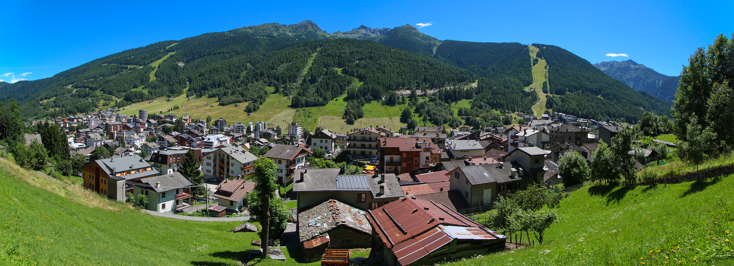
Stage 16 is, without doubt, the heart of the 2027 Giro. From Sondrio to Aprica, 192 kilometres, with elevation gain of about 5,700 metres. The course climbs the Passo del Mortirolo, crosses the Passo di Gavia, and then climbs the Mortirolo once more. There is no precedent for a stage that packs passes the Giro's history calls sacred into a single day at this density.
The Valtellina is a long valley running east–west along the Adda river. Sondrio is its central town, and terraced vineyards cover the south-facing slopes of the valley. In the valley's northern and southern walls stand two passes. In the southern wall, the Mortirolo, at 1,852 metres. Further up the valley to the north, the Gavia, at 2,621 metres — this edition's Cima Coppi, its highest point.
The Mortirolo should surely be entered through the race's memory first. At the 1994 Giro, on the stage that crossed this pass towards Aprica, a young Marco Pantani rode away alone and reached the summit of his powers. It was his second stage win of that year's Giro, and that climb has been told and retold, ever since, bound to his name. A monument to Pantani now stands partway up the pass, and on the 2027 course, too, the Mortirolo is designated the "Montagna Pantani" — Pantani's mountain. The ascent from the Mazzo di Valtellina side is about 12.4 kilometres, its average gradient over 10 per cent, and it is known for the way its narrow road through the forest shaves the legs away without mercy. This is not a pass for enjoying the view. It is a pass closed in on itself, like an ascetic practice.
The Gavia is its opposite. This pass, which appeared in the Giro in 1960, opens the valley out as it climbs from the Ponte di Legno side, and glacier-bearing ranges spread into view. And what many fans recall at the name of this pass is the snow stage of June 1988. Through an out-of-season blizzard, the riders crossed the pass with their goggles fogging, Erik Breukink took the stage, and Andy Hampsten pulled on the maglia rosa. Since that day, the Gavia has been remembered as "the pass where you fight the weather". At a summit of 2,621 metres, even at the end of May the weather may show no mercy.
Seen from the side of towns and roads, these passes are routes of daily life and trade linking two Lombard valleys, the Valtellina and the Val Camonica, and in the First World War they were also military roads near the front. Narrow, steep, closed in winter — and still people kept crossing. The race lays its own memory over that old repetition of crossings.
Mortirolo, Gavia, and Mortirolo again. Each time they descend, the riders return to a valley; each time they climb, they face a mountain with a different face. The finish is Aprica, the pass town at the eastern end of the Valtellina, where the roads divide towards Teglio and towards Tirano. Aprica was also where Pantani won in 1994. Today's course deliberately retraces, once more, the ground of that famous scene of thirty-three years ago.


Stage 17 — Chiari to Vo' (194 km)
The day after the queen stage, the race returns to the plain. After a transfer from Aprica, the peloton starts in Chiari, a town of the Lombard plain, and rides to Vo' in the Veneto, 194 kilometres. In the final part, a cluster of short, fierce little climbs in the Euganean Hills awaits.
The Euganean Hills are a scattering of volcanic hills floating, alone, in the middle of the Po plain. To eyes that have ridden flat land for hours, that sudden rising comes strangely fresh. Vineyards and olives spread over the hills, and hot springs rise in the towns at their feet. The village where the poet Petrarch spent his last years also lies at the edge of these hills. Vo', the finish, is a town at the western entrance to the hill country. Still carrying the afterglow of yesterday's 5,700 metres, the peloton crosses several waves of hills and ends the day.
Stage 18 — Rovereto to Madonna di Campiglio (154 km)
Stage 18 is a mountain stage to the western entrance of the Dolomites. It starts in Rovereto, crosses the Passo Duron twice and the Passo Daone, and reaches the summit finish at Madonna di Campiglio, 154 kilometres.
Rovereto is a town of the Adige valley, and in the First World War it lay close to the front between Italy and Austria. On the town's hill is a huge bell mourning the war dead. Cast, it is said, by re-melting the bronze of both armies' cannon, the bell now rings out over the valley every evening at dusk, as a bell praying for peace. The race leaves that valley and climbs into the embrace of the Brenta Dolomites.
Madonna di Campiglio is a highland resort facing the rock peaks of the Brenta group head-on. Its tourism began in the later nineteenth century, when the aristocracy of the Austrian Empire came for the summer and the Empress Elisabeth also stayed; it carries the nickname "Pearl of the Dolomites". The same empire as Trieste has left its trace here, too, in the form of a mountain holiday. That separate faces of one empire appear at the start of this race and again in its closing stages is part of the interest of this year's course. The view of the rock walls dyeing red in the evening is exceptional even among these mountains. As a finish, this is a summit finish for the scenery. As the price of that scenery, the riders will have to climb Daone's narrow mountain road.

Stage 19 — Rovereto to Sacile (199 km)
Before the mountain stage on the last day but one, Stage 19 is a long day of hills. From Campiglio the race returns to Rovereto to start again, passes Vigolo Vattaro and Bieno, crosses the climbs of Montaner and Castello di Caneva in the final part, and reaches Sacile, 199 kilometres.
The course stitches eastwards along the foot of the mountains, from Trentino into Friuli. For the riders contesting the overall, this is a day they would like to keep quiet, ahead of tomorrow's Zoncolan — but the course's undulations continue just enough not to allow it. Sacile is a town blessed by the waters of the Livenza river, called "the Garden of Friuli". Its calm riverside townscape is placed at the end of this long day. That calm will be remembered, no doubt, in contrast with the wall of the following day.
Stage 20 — Pordenone to Monte Zoncolan (180 km)
Stage 20 is the final showdown. From Pordenone it enters the mountains of Carnia, crosses the Passo Duron and the Sella Valcalda, and reaches Monte Zoncolan. The final climb, from the Ovaro side, is 10.1 kilometres at an average gradient of 11.9 per cent, 22 per cent at its maximum. Of all the Giro's climbs, the Zoncolan is the mountain that most often receives the description "the hardest".
The Zoncolan first appeared in the Giro in 2003, the year Gilberto Simoni won on it. Since then the mountain has shown itself every few years, and each time it has broken the contest for the overall apart. The climb from the Ovaro side is a narrow road through forest, with almost no section where the gradient relents. For ten kilometres the figure stays pinned around double digits. It is neither a climb of scenery nor a climb of rhythm — an ascent where, it seems, only the gradient exists.
Carnia, at its foot, is a mountainous corner of Friuli: a land of woodwork, of mountain cheese, and of the memory of the First World War front. And in those mountains stands the wall that cycling fans all over Europe name when they say "one day". On the day before the glory of Rome, the race entrusts its last strength to this wall. The question of the overall victory will probably be settled in these ten kilometres. — Having written that I would make no predictions, about this mountain alone I cannot help writing so.

Finale — Rome (Stage 21)
Stage 21 — Rome to Rome (131 km)
On the final day the race transfers the long distance from Friuli to Rome, and closes in the Eternal City itself. Stage 21 runs 131 kilometres, eight laps of a city circuit of about 9 kilometres: down the Via dei Fori Imperiali, past the Colosseum. In recent years the Giro's finale has settled in Rome, and the circuit threading between ancient ruins has become the scenery of the final day.
Rome is, as everyone knows, an imperial capital. But seen through eyes that have followed these three weeks, Rome is not a mere "finish". The port of Trieste was the window the Habsburg Empire opened to the sea; that empire no longer exists. Slovenia's capital and its port are now the daily life of another country. In the Apennine valleys, recovery from the earthquake continues; on the Alpine passes, the memory of a young man of thirty-three years ago stands as a monument. The race descended south and climbed north, stitching all of it together with a single line, and has come back, at last, to this city.
One of the pleasures of watching a Grand Tour, I think, is this sense of "the line". Whoever the winner is, the line drawn over three weeks remains. Next year's Giro will draw another line, and that line, too, will trace over the old stories of the land. The line of 2027 was drawn from a border port to the Eternal City. It was to remember that that I wrote this piece.

Closing — The Line Remains
Three weeks, twenty-one stages, 3,418.9 kilometres. Inside those figures were a port, a border, a drained lake, a monastery valley, a plateau still rising from an earthquake, and passes holding snow. Until the race passed, they had lain scattered within the country called Italy. Because the race passed, they came to stand in a row, on a single line.
Of course, the line disappears. By the following week, no one is talking about the course any more. And yet, whether on a map or in memory, a line once drawn has a strange persistence. Next May, or on some journey years from now, if I find myself standing at the port of Trieste, in the valley of Norcia, or on the Mortirolo's forest road, what I will remember then is not the results table, but this line.
From a border port to the Eternal City. This piece is left here as the record that the 2027 Giro was such a journey.